F4S Drone 4K HD Camera Three-sided Obstacle Avoidance Air Pressure Fixed Height Professional EIS Drone GPS Folding Drone
F4S Drone 4K HD Camera Three-sided Obstacle Avoidance Air Pressure Fixed Height Professional EIS Drone GPS Folding Drone

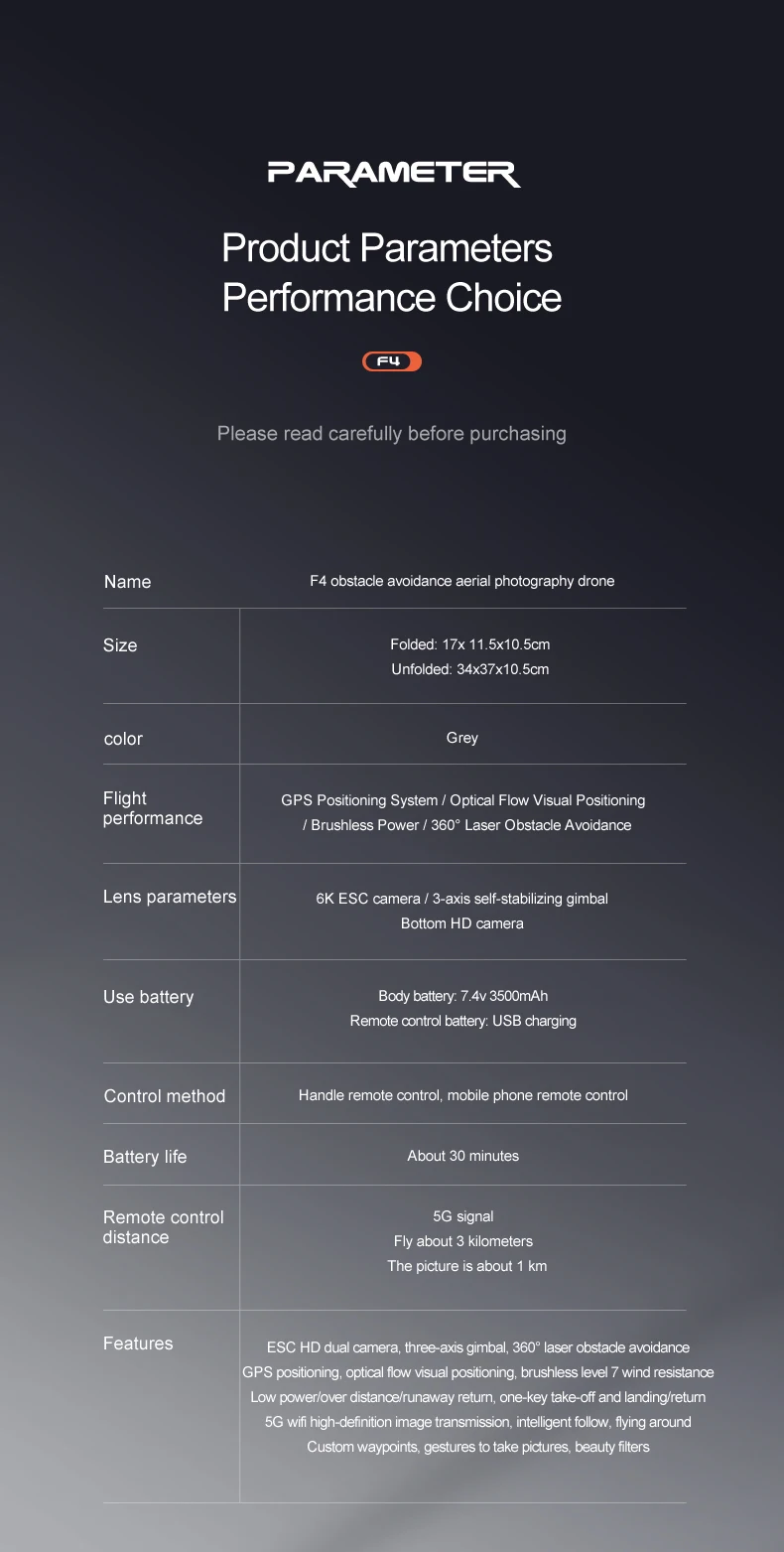
Product name: F4S 3-axis obstacle avoidance drone
color: grey
Packing: Carrying bag
Battery capacity: 7.4V plug-in smart 3500mah lithium battery
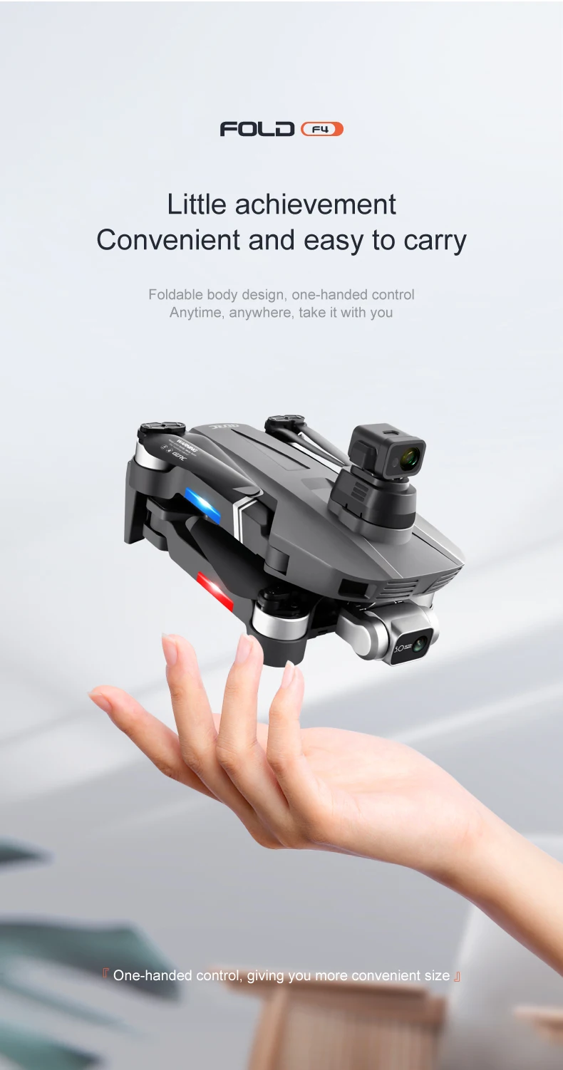
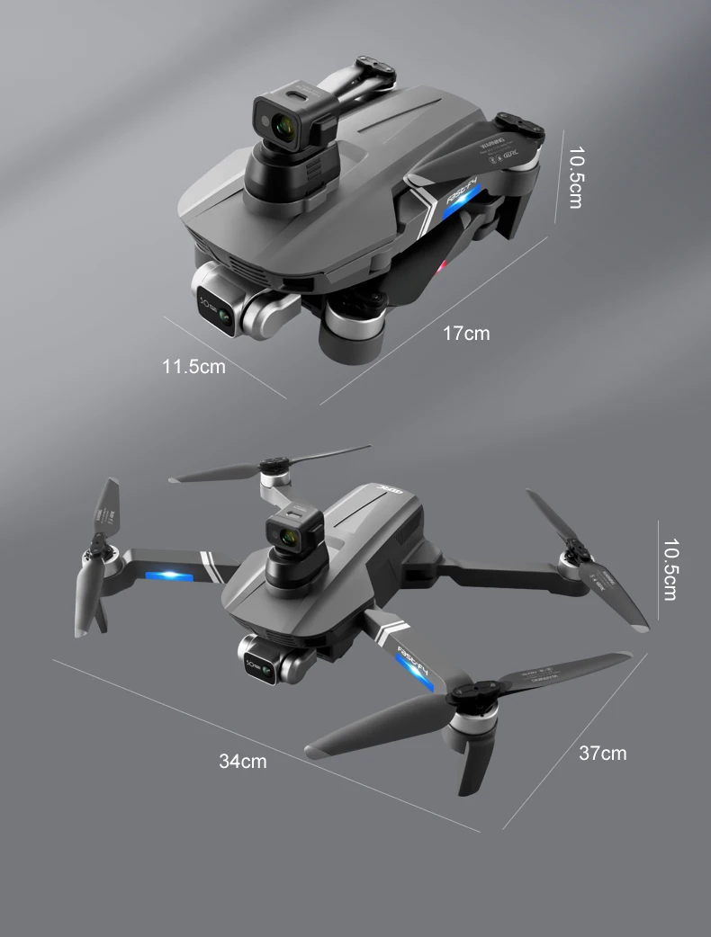
Aircraft size: 36*33*7CM
Aircraft folding size: 17*10.5*7CM
Black carrying case size: 32*11*24cm
Remote control charging time: about 2 hours
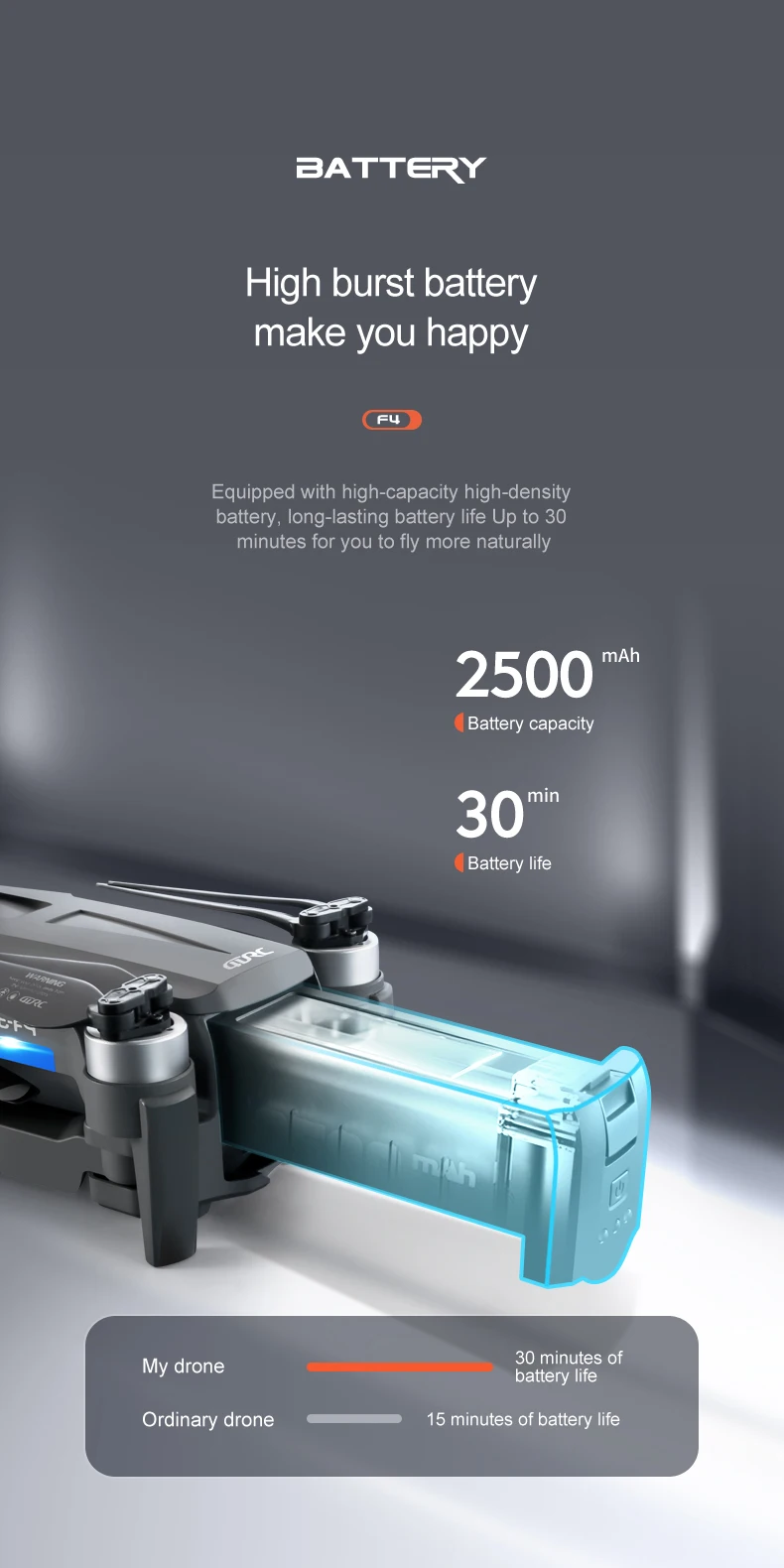
Drone flight time: about 25 minutes
Remote control battery life: rechargeable remote control, built-in lithium battery, fully charged remote control can achieve 3.5 hours long battery life
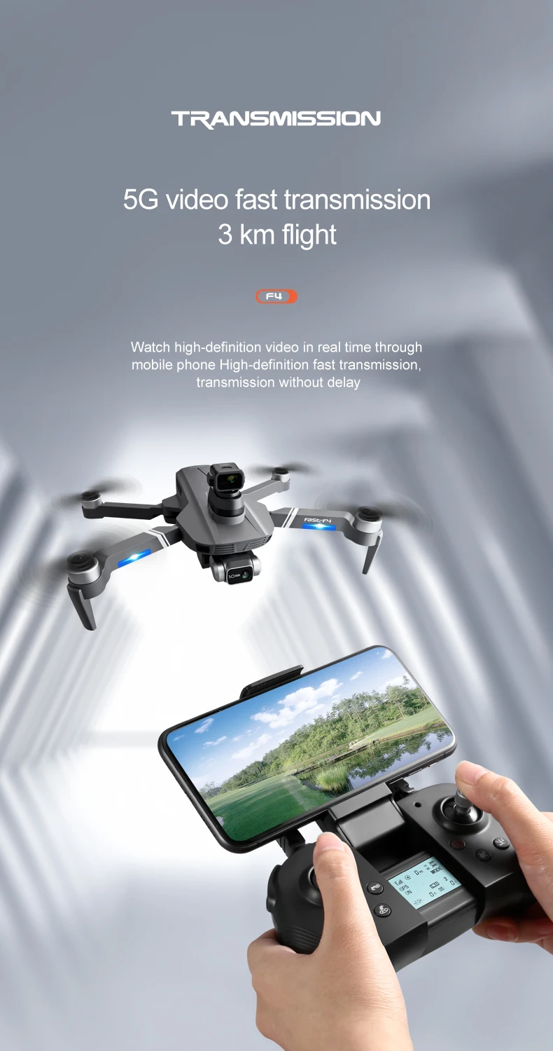
Flight range (remote control length and distance): about 2000 meters, about 2000 meters for image transmission
Flight range (remote control altitude distance): 120 meters
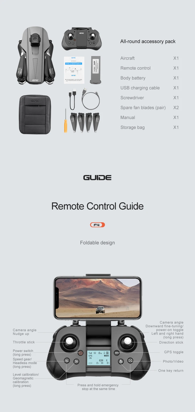
Delivery items: Spare AB fan blades (pair)*2PCS, Lithium battery USB charging cable*1, remote control USB charging cable*1, screwdriver*1, instruction manual*1
Product Features:
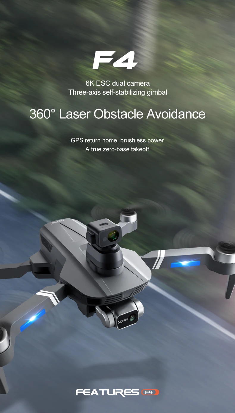
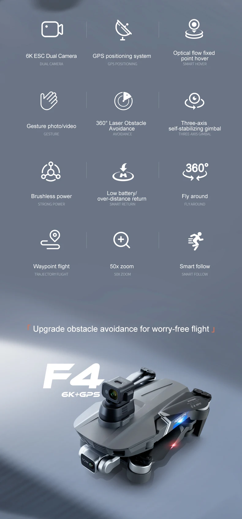
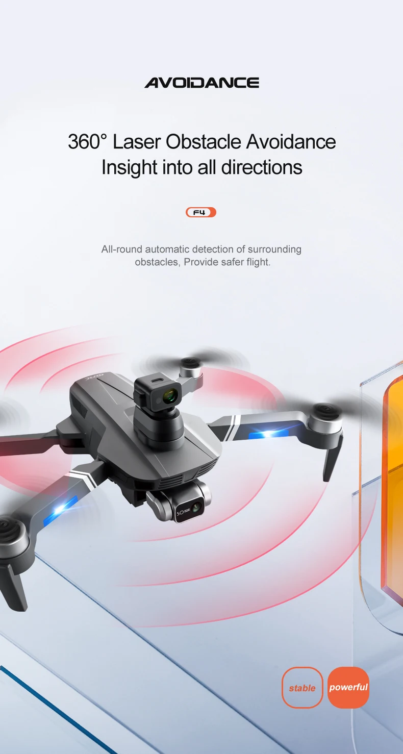
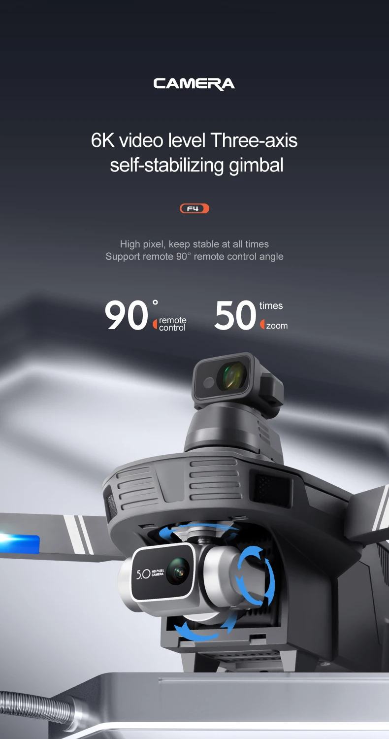
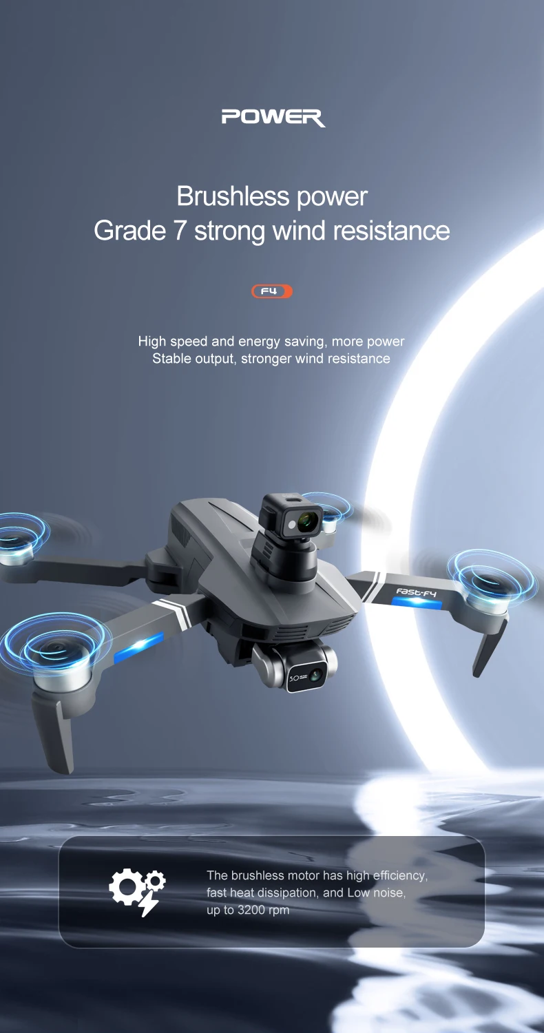
Stable 3-axis mechanical gimbal, 360-degree obstacle avoidance
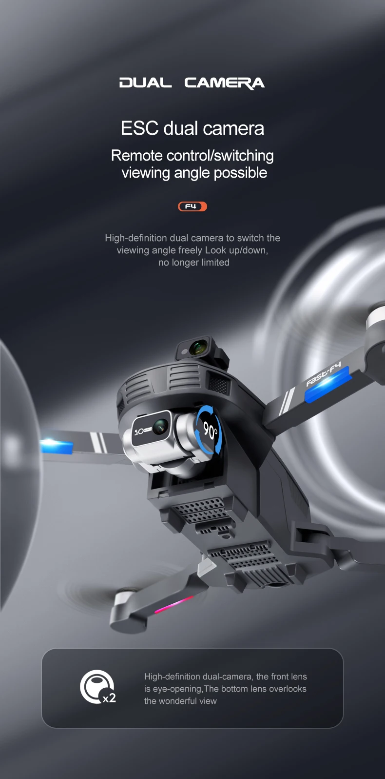
4K wide-angle 120° adjustable camera. ESC camera
The mobile phone APP interface displays GPS flight status and data, can take photos and videos, and control
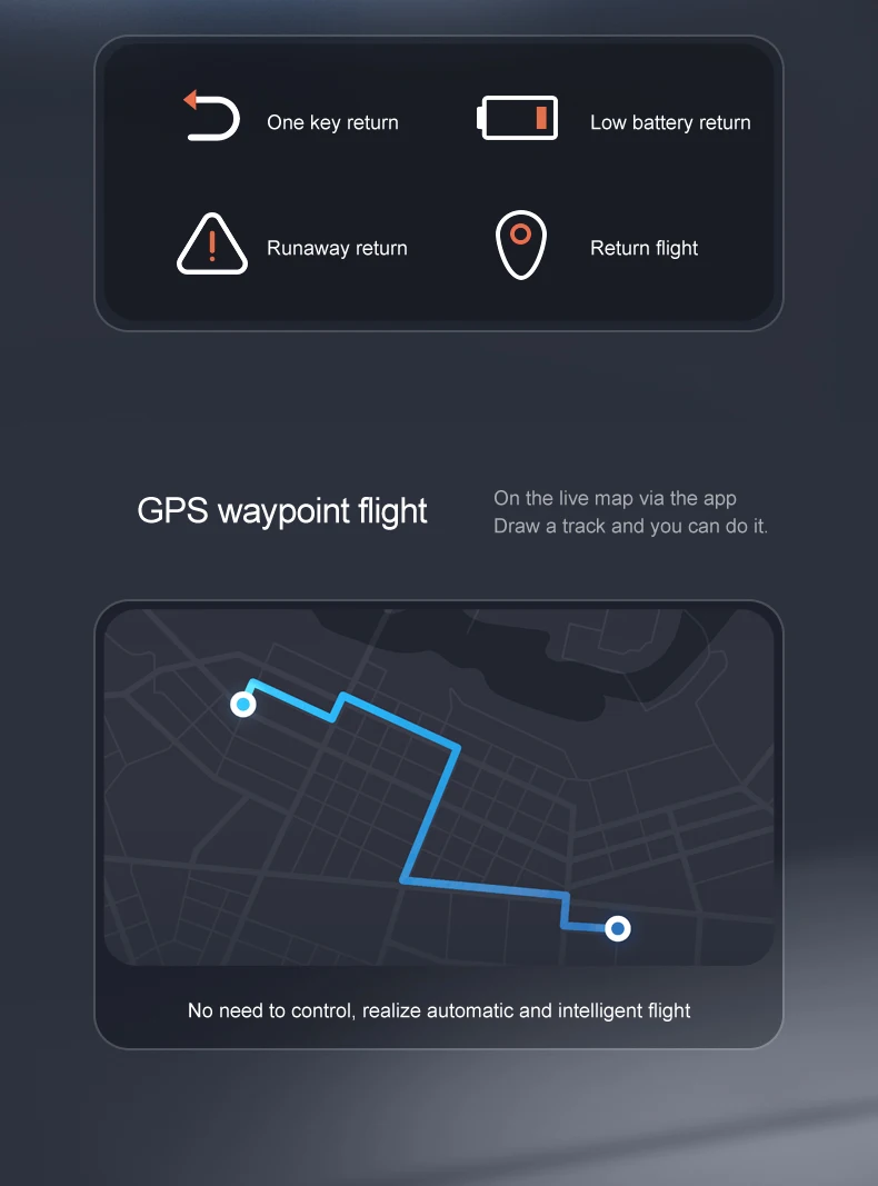
Aircraft retrieval function: Click the GPS signal icon 3 times continuously to open the map interface. The map displays the last distance, latitude and longitude position of the aircraft.
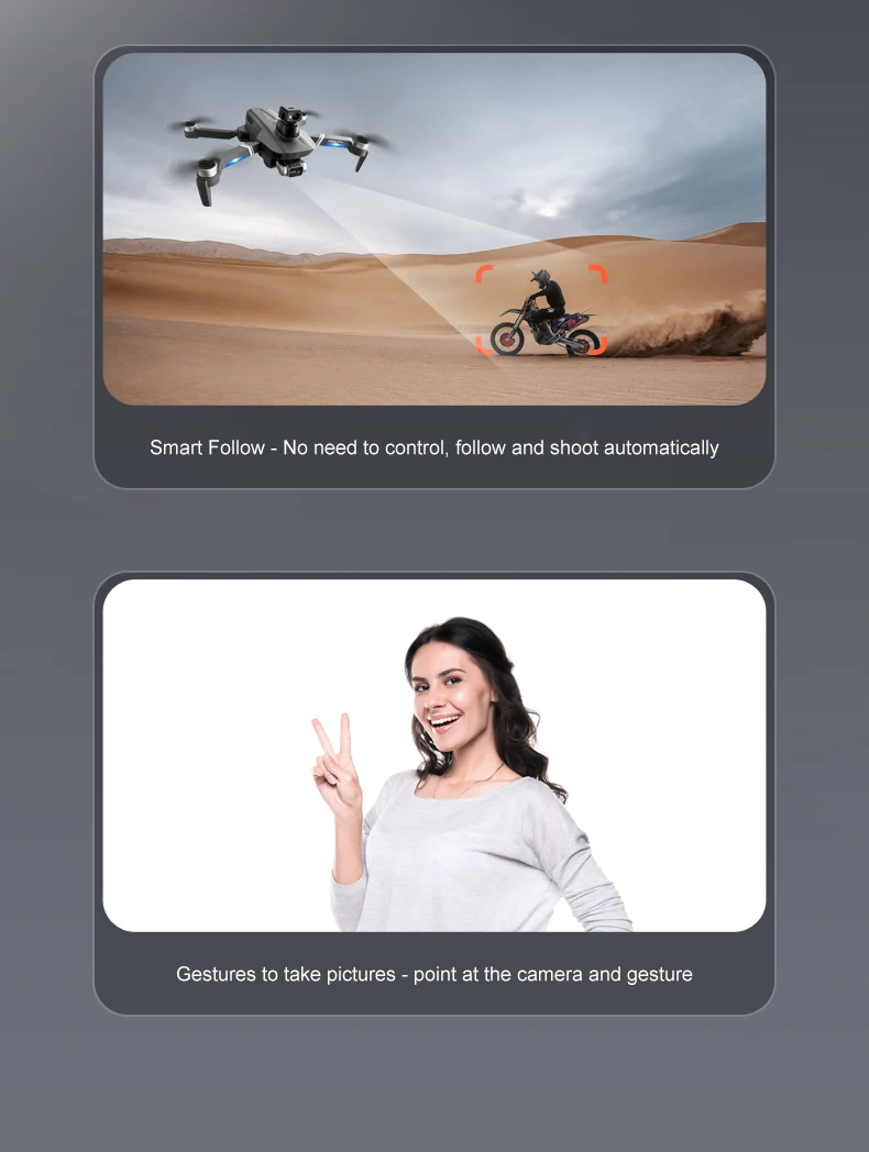
① GPS intelligent follow; ② Image follow: Identify the subject and automatically follow the flight.
Route multi-point planning flight: The aircraft flies autonomously according to the preset route, and the player focuses on shooting.
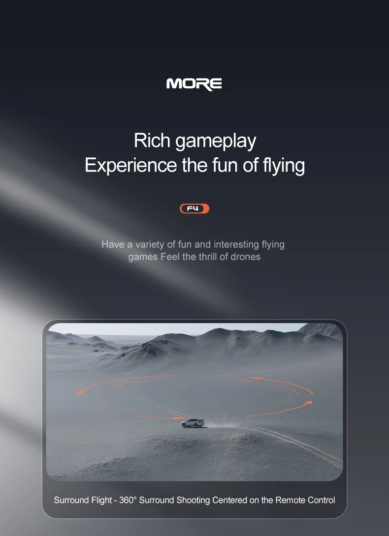
The mobile phone is flying around (the lens is always aimed at the target) to find the center point of the circle, and then move the desired circle radius with the joystick.
Gesture shooting recognition: within 1-3m of the aircraft, make a photo gesture/camera gesture facing the camera.
Pictures, music and videos can be shared: You can single-select or multiple-select to share photos, and videos can only be shared individually at a time.
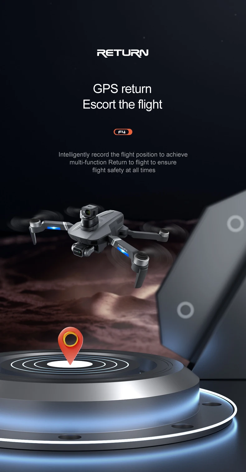
One-key takeoff on the remote control / mobile phone follow / mobile phone map site route flight / landing / return (the camera will be aimed at the operator when returning to home), which is convenient for the operator to control
GPS returns to the take-off point with one key, low power and signal loss will automatically return to home